Lincoln, Neb. —On a hot June day in 2022, Catherine Chan walked into the Sandhills with a team of university researchers and realized she had walked into an ecological mystery.
“It was a very warm evening, but when we walked into the interdunes, it changed from dry and soil-exposed to green and lush,” the Nebraska doctoral student said. “The ground felt spongy and moist, and it felt like you were walking into an air-conditioned room. That microclimate aspect really interested me.”
Having come from Maine and forest studies, she wondered how the many different grasses and flowers thrived in the heat, wind and sand. She decided to look into this biodiversity mystery, not with a detective’s magnifying glass but with a scientist’s tools of remote sensing.
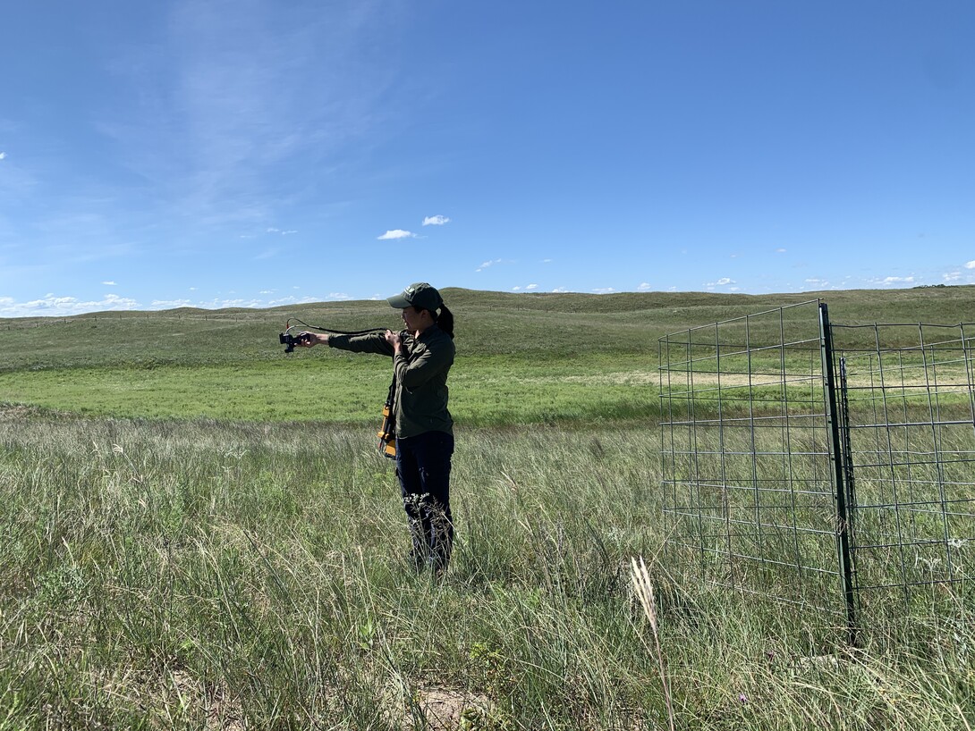
Chan identified and counted plants in 640 one-meter plots at the same dune site, Barta Brothers Ranch near Rose, Neb., last summer. She plans to do another count there this summer and compare her on-the-ground records with remote-sensing images of the same one-meter plots. The remote-sensing images come from the university’s plane, Nebraska Earth Observatory, and from a handheld spectrometer.
Chan also plans to compare her data to historical records of ranch vegetation. Dave Wedin, professor in the School of Natural Resources, headed a team studying the effects of blowouts on vegetation regrowth from 2006 to 2010. Chan has that team’s data and also data from the early 2000s when Walter Schacht, professor in the Department of Agronomy and Horticulture, headed a team looking at plant communities as related to topography.
One of Chan’s advisors on the project, Daniel Uden, a resilience spatial scientist, said they hope remote sensing can detect changes in vegetation and any effects on the land of different management treatments. Barta Brothers Ranch management is testing the efficacy of two treatments, rotational grazing and prescribed fire with grazing, at keeping land resilient and trees from spreading into Sandhills grasslands.
“The idea ultimately is that we'll be able to get this information over a large area much more efficiently than we can with sending people out with the clipboard to count individual species,” Uden said. “But it's a very complex challenge to do that. Her research is focused on helping unravel that mystery.”
Using remote-sensing, Chan is able to detect parts of the electromagnetic spectrum that human eyes cannot. Different species of plants absorb and reflect light in different ways at different stages of their life. Some of that light humans can see, but the rest is invisible. Chan is trying to determine how that reflectance corresponds to plants and their makeup.
In her remote-sensing experiments, Chan and three other researchers lay 10-by-10-meter tarps on the ground on sunny, cloudless days for the university’s plane to fly over and measure light reflectance.
“We're taking methods that have been well established in chemistry and biological laboratories for decades and pointing them at the surface of the earth and looking at absorption features,” said John Gamon, the remote-sensing scientist advising Chan. “In a sense, you can think of these spectra as fingerprints. They characterize specific things about the surface of the planet, and that includes species composition and the biological as well as the abiotic, or the physical properties of the landscape. So, we're trying to learn about the biological properties, but part of the challenge is teasing apart the biological from the physical, and then understanding what really drives those signals.”
Remote sensing can pick up signals from other things such as shadows, rocks and soil. Gamon said they try to correct for those using image-processing methods, statistical methods and spectral analysis.
They are also trying to use the historical data to determine whether the biodiversity has changed over time and, if so, what drove those changes.
One problem Gamon said they have run into when trying to use the historical data to determine this is people collected the data with different purposes in mind. While the remote-sensing team collects images from one-meter plots, with the plane flying at a height where every pixel is equivalent to a meter, past research teams collected their data from varying plot sizes. The remote-sensing team is left resampling pixels trying to compare apples to apples.
“If you don't do it the right way, it looks like you get nonsense, but the moment you actually plan the fieldwork with the airborne work, then the magic happens,” Gamon said.
He said he thought Chan was the first person to try to use remote sensing at Barta Brothers Ranch to detect biodiversity but he knows of scientific teams trying this same thing in other places.
Scientists have the idea, he said, of developing a global biodiversity monitoring system incorporating remote sensing from satellites, from aircraft and from field measurements, with things like environmental DNA to track biodiversity levels, see how they're changing and gain understanding of what drives biodiversity.
Developing such a system requires expertise from various scientific disciplines and from the people working on and managing the land. This interdisciplinarity poses another problem, vocabulary. People use different terms, like heterogeneity and biodiversity, and sometimes define them differently, but they still agree it’s important to have species diversity, Gamon said.
“Biodiversity and productivity tend to be associated in grasslands,” he said. “A more diverse system tends to be a more productive and a more resilient system. So, there are these larger questions, but the more immediate question really is to test the basic hypothesis that spectral diversity, variation in spectral reflectance and patterns of spectral reflectance, tells us something meaningful about biodiversity at some level for Barta Brothers Ranch.”
Comparing the remote-sensing data and on-the-ground measurements with historical data, they have thus far seen cyclical patterns of wet and dry periods with accompanying huge changes on the land, Gamon said.
Despite that, they have not seen instability in the Sandhills yet, Chan said.
“There's often this idea that the grasslands or the sand dunes are unstable, but that doesn't seem to be the case, at least not in short time frames,” she said. “Maybe over geologic time scales.”
Still, she said it’s critical to keep the Sandhills in a stable state because they provide many resources, such as habitat for livestock and wildlife, and they filter and recharge the Ogallala Aquifer below them.
“The Sandhills are really unique in the world, so I think it's important to place a lot of consideration to this,” she said. “It's an asset, whether thinking about it as a resource or just in thinking about its aesthetic. I think it's very underrated, to be honest.”
She spoke to about 20 people at a stakeholders’ meeting at the ranch on July 25, 2023, about her research. She enjoyed talking to the stakeholders because they fell along a range of willingness to adopt technology and were forthright in their views, she said.
Gamon said he saw her ability to communicate with the wider world as a strength she could use going forward into a career.
Chan remains open on what career path she will follow once she has graduated but expressed certainty about one thing.
“Remote sensing is my background, and it's going to be my future,” she said.