July 2, 2014
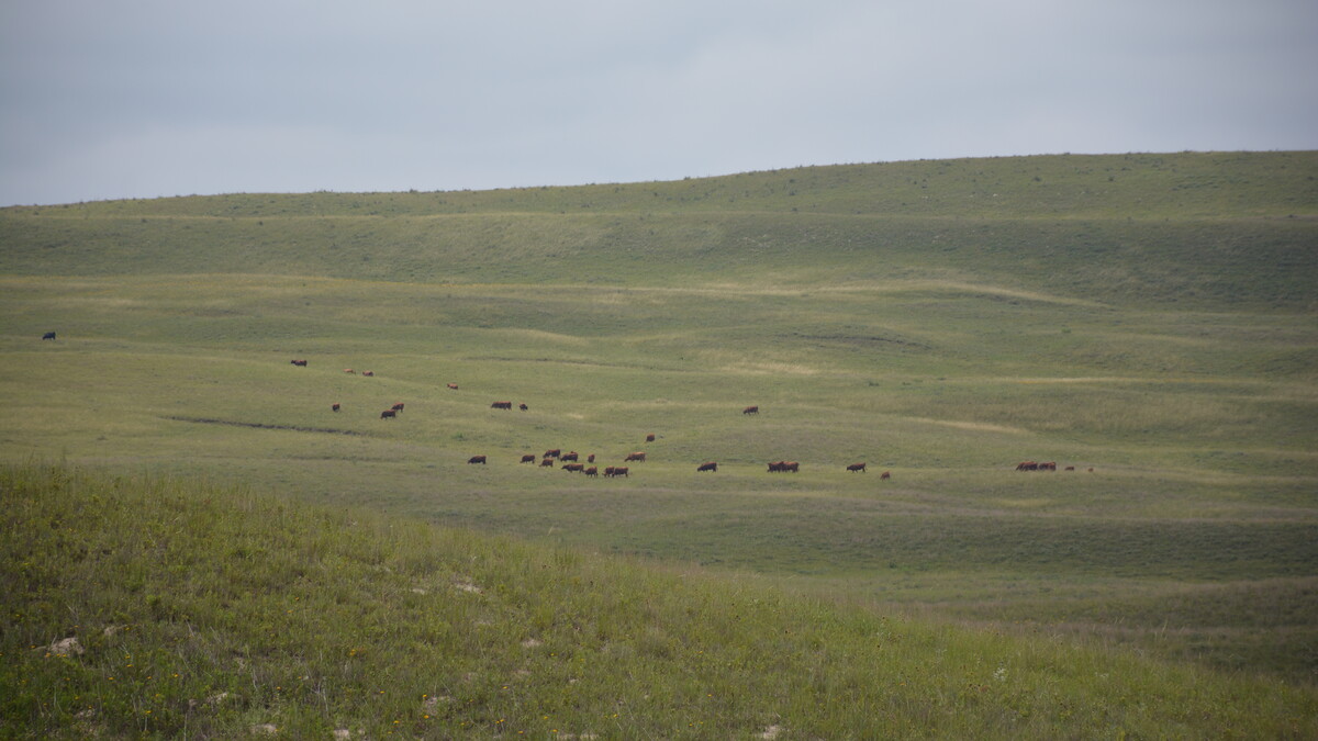
LINCOLN, Neb. — Ranchers are accustomed to checking cattle, wells and mineral supplements to keep tabs on their operation. But what about the grass?
Monitoring the condition of pastures is just as important, say University of Nebraska-Lincoln Extension experts. And now there’s an app for that.
UNL Extension has released a mobile application called “GrassSnap” that makes the monitoring process easier. The new app takes ranchers through the monitoring steps; stamps the photographs with the pasture name, GPS location, date and direction; records comments about each pasture; and stores the photographs and data in pasture folders. The information can quickly be downloaded to a computer.
The new app is available for Apple and Android operating systems, both for smart phones and tablets. Download GrassSnap for Apple versions at the iTune Store, and Google Play for Android devices. The app is free, thanks to support from the Nebraska Grazing Lands Coalition.
There are many reasons to monitor rangeland and pastures, said Bethany Johnston, UNL Extension educator. She said all managers should monitor to evaluate changes and progress towards their management goals. Others need to document pasture health for carbon credits, wildlife habitat, or compliance with government programs such as the NRCS Conservation Security Program, which includes a grazing monitoring enhancement opportunity for participating landowners.
“Photo-point and photo-plot monitoring is one of the easier, more repeatable ways to get qualitative info about how pasture looks right now.”
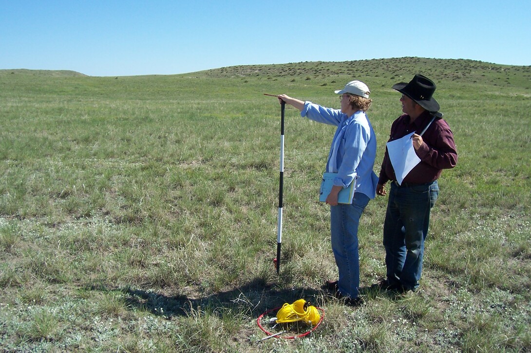
A mantra of the method is “look out and look down.” First, “look out” and capture a photo-point landscape view. Next, establish a line transact in a given direction, then “look down” at the ground at regular intervals along this line to capture photo-plot views.
Looking down at the ground is likely to reveal a whole host of rangeland health indicators, such as the amount of litter on the soil surface, types of vegetation and condition of the plants.
“We want to get them to look out (at a pasture) and see what that view looks like – but also drive or walk out into it and look down and see what you see,” said Cindy Tusler, former extension educator who helped develop the GrassSnap app.
Monitoring pasture conditions is not a one-size-fits-all process.
“Collect information that works for you,” said Johnston. “Your monitoring system can be simple, like a moped, or a higher-end version, like a Cadillac. The ‘moped’ version could be as simple as a photo point and a photo plot. More complex monitoring will bring more detailed data. For example, we set up a ‘Cadillac’ version for a rancher complete with a transect line, spaced photo plots, a perspective pole, and a data sheet to record our information.” GrassSnap is flexible enough to capture data on simple or more complex monitoring systems.
It is recommended that photographs be taken at least once a year, after the growing season when plants have matured. The goal of the new app is to make this process quick, repeatable, and easy.
The app employs Geographical Positioning System to make it easier to return to the same spot every year. Once at the site located by a permanent field marker, the app user can use the “overlay” or a ghost image (from the first year) on the screen. This allows the user to hold up the phone or tablet, then move the device until the ghost image lines up with the live image making for more consistent and repeatable pictures.
The app helps collect and upload data. Then, during late fall and winter, a rancher can review it, make decisions, and be prepared for next year, she said.
“This is a decision support tool. It will give you easily repeatable information that helps you make decisions. It doesn’t make the decision,” Tusler commented.
Johnston agreed that human judgment is important. “Each person’s management goals are different, so monitoring and assessment will flow out of those goals. The app makes it easier to remember and compare conditions from one year to the next at exactly the same site.”
The app is complemented by a new NebGuide on pasture monitoring. “Getting to Know Your Pastures, Techniques to Enhance Monitoring,” written by Johnston, Tusler, and Jay Jenkins of Cherry County, and Jerry Volesky, UNL range specialist, can be viewed online.
Questions about the GrassSnap app can be directed to Bethany Johnston at the Central Sandhills Area Extension Office in Thedford, 308-645-2267 or visit the GrassSnap webpage at centralsandhills.unl.edu/GrassSnap.
Bethany JohnstonUNL Extension Educator
308-645-2267
bjohnston3@unl.edu
David Ostdiek
Communications and Technology Specialist
308-632-1252
dostdiek4@unl.edu
Dan Moser
IANR News Service
402-472-3030
dmoser3@unl.edu
Click here for larger photo