Lincoln, Neb. —In the late 2010's, Paul Merani had a full-time postion as a GIS specialist at the College of Arts and Science and was a student center for Advanced Land management Information Techologies (CALMIT) in the University of Nebraska-Lincoln's School of Natural Resources. He was working on a multi-year Nebraska Army National Guard grant-funded project at the University of Nebraska-Lincoln that was nearing its conclusion. Yes, he thought, the grant would likely be renewed. But Merani, who first came to CALMIT as a grad student in 2003, was ready for something more permanent, so he started scanning for federal postiions. When he saw a U.S. Border Patrol listing in search of a cartographer, he was interested bu admittedly a little naive.
“I didn't really know what Border Patrol was, honestly,” Merani said. “I looked at it like, well, I'm currently contracted to the military, and the military needs geospatial professionals. So, I'm sure law enforcement uses us, too. I figured I'd be doing some of the same work.”
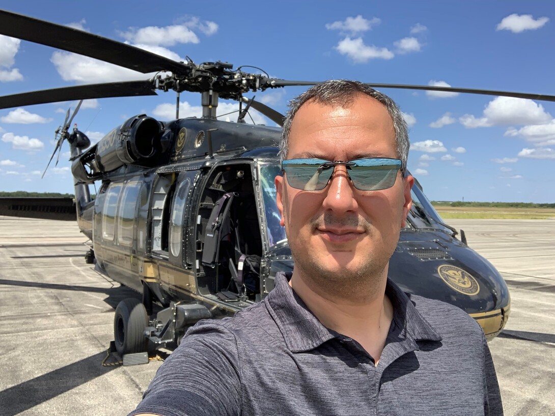
Merani got the job in late 2017 as he was completing his Master of Science at Nebraska, and started as a cartographer in the Sector Intelligence Unit with the Border Patrol’s Rio Grande Valley Sector. The work turned out to be, Merani said, completely different. For the Guard, Merani had helped distill massive reports about the physical conditions of all National Guard facilities in the United States down to a set of quickly comprehensible maps. For the Border Patrol, his work has contributed to life-saving efforts.
In his first weeks on the job, Merani toured the Texas-Mexico border with groups of new coworkers. As he learned about different initiatives, he was introduced to the Missing Migrant Program, a team of agents dedicated to rescuing migrants in distress and identifying the remains of those who did not survive so that the families can be notified when loved ones are lost. The mission resonated with Merani.
“My father was an immigrant; he came to the United States from India,” Merani said. “My wife is an immigrant; she came to the United States from Ukraine. So, anything that deals with immigration is close to my heart. I've traveled to dozens of countries around the world, many of them impoverished. I have a deep love and appreciation for this country, and for all of the things that this country provides that we take for granted.
“I certainly empathize with and sympathize with people that want to come here. You'd be foolish not to want to give your children the same experiences that my family was able to provide for me, and all of our families have been able to provide for us.”
During his introduction to the Missing Migrant Program, Merani learned that human smugglers often leave behind people who have overheated or suffered an injury during the arduous trek across remote landscapes. He learned that people on the taxing journey across the border often call 911 when they are in distress. But cellular signal across the areas where crossings take place is typically spotty and imprecise. A half-mile in location error, Merani said, can mean life or death when rescuers are trying to reach someone who made a distress call.
When Merani was a grad student at Nebraska, he was diagnosed at the University Health Center with severe dyslexia. It affirmed diagnoses he received as a child, but his response to it then was to hide it.
“I was very ashamed of it,” he said. “I never let anyone know. I would have a lot of trouble with reading comprehension, and I had trouble getting assignments, reading them, understanding them and repeating them in class. And I just kind of let people think that I wasn't all that bright if that's what they wanted to think, because I was ashamed of it.”
While reading was a constant challenge, he gravitated toward geography, a visual field.
“I can see, spatially, patterns and trends and information that I can glean out of a map much better than I can get that same information from reading text,” Merani said.
And he can help others pick up critical information quickly. With the Missing Migrant Program, Merani saw an opportunity to improve response times by building a mapping and communication system. Using ArcGIS Online, he designed a system that improved the ability to identify the locations of migrants and quickly share the location with agents, aviation support and others involved in the rescue while also providing an interactive management system that allows for real-time overview and analysis of the operations. Merani’s mapping system helps Border Patrol agents, local law enforcement and rescue crews quickly determine who is closest to the party in distress and collaborate on rescue efforts. Since the system has been in place, the Missing Migrant Program has rescued more than 1,000 people who have placed distress calls.
Merani said that he learned how to utilize spatial technologies for real-world projects during his time at CALMIT.
“The basic principles of data collection, identifying requirements, the importance of field work, application-based goals – all the critical thinking and project development techniques I applied to this project – I learned from the faculty and staff and CALMIT and UNL. There is no better teacher than doing something, and CALMIT’s resources are like no other program in geospatial science, anywhere.”
CALMIT director and UNL remote sensing scientist Brian Wardlow said Merani is a prime example of how skills in spatial technologies and analytics can address key societal issues when applied in creative ways.
“At CALMIT, we train students to not only to become technical experts in remote sensing and GIS, but more importantly how to apply spatial thinking and information to solve real-world problems,” Wardlow said. “Paul is the latest in a series of CALMIT students to applying their spatial skills in meaningful, practical ways in both the government and private sectors. We are proud of Paul’s professional accomplishments and applaud his efforts to develop practical solutions in support the U.S. Border Patrol mission.”
In 2019, Merani was awarded the U.S. Border Patrol’s Meritorious Achievement Award for his work developing the system. Last year, he was presented with the Professional Employee of the Year award. The praise was a bit uncomfortable, he said, because he felt like a small part of a much bigger effort. He prefers to consider the honors as a recognition of the project’s importance, and of the rescue work that everyone involved in the Missing Migrant Program has conducted.
“I feel like it's a drop in the bucket, and I wish I could do more,” said Merani, who is currently working on developing the system so that it can be deployed across all the U.S. Border Patrol sectors along the U.S./Mexico border. “I just hope that my contribution leads to more and more success in these kinds of humanitarian efforts in the future. If my contribution sent one person back to their family and loved ones, then that's a legacy that I'll die very proud of having.”
Merani took some time recently to answer questions about the system, and about his time at Nebraska, where he earned both Master of Science and Master of Arts degrees while at CALMIT.
What can you tell me about some of the common hazards that people face when they are lost or stranded in the countryside in your sector?
We have a lot of ranchland that's fairly sandy and desolate. If you've ever gone hiking through the Sandhills or tried to do some exerted activity on a beach, you know what it's like to try to trek through sand. Imagine doing that at roughly 30 degrees latitude, a little bit south of that, where the sun's beating down on you. And you're looking at temperatures of upwards of 100 degrees. And you have minimal provisions, if any. And of course, your equipment is limited to the clothes on your back and the shoes on your feet. And you're a normal person. You're not an athlete, you're not a soldier who's gone through boot camp. You don't have the kind of conditioning for a three- to four-day hike through this kind of terrain. And that in and of itself is what these people are often pushed to by these smugglers.
Any number of things can befall them at that point. People get lost, people fall and break bones or otherwise get injured. People succumb to illnesses, rhabdomyolysis in particular, where your body just simply starts to shut down while you're alive. Dehydration, obviously. There are any number of medical issues that people can have, and unfortunately these smugglers and traffickers view migrants as a commodity. And if they have to lose one or two people, that's part of the cost of doing business for them. When people eventually realize the smuggler is not coming back for me, they call 911, and that's where Border Patrol and this system come into play.
Can you describe how this search and rescue system was developed and how it works?
The system is based on Esri's ArcGIS online software, or AGOL. The AGOL platform is an interactive, web-based mapping system that is designed to be open. The actual platform that most people use is sort of open source and almost anyone can go in and look at stuff. It's meant to be shared. We have a version of that I was able to tap into and create this interactive platform that provided real-time situational awareness of rescue events to all of our partners that are involved in a rescue.
That includes people in the field, people providing aerial support for search and rescue, people providing medical support and people coordinating all of these activities at the dispatch centers. So everybody can get on board with the system and see what's going on and see all of the information that they need to, live on a map. Human beings are very visual. So seeing the information, rather than hearing it relayed in a phone call or reading it in an email, just really brought the whole rescue effort alive in a way that had never been done before.
How did the skills you learned at UNL’s Center for Advanced Land Management Information Technologies CALMIT help in the development of this project and in your work with U.S. Border Patrol?
That's an awesome question. I feel like I owe all of my success to CALMIT and the University of Nebraska. I lived in Nebraska for over 15 years of my adult life. I didn't want to leave Lincoln. I fairly quickly forgot my Maryland roots where I grew up and feel like a true Cornhusker. I owe it all to the university.
The answer's a bit complicated, because the software, the technical aspect, you can learn that anywhere, really. I didn't need CALMIT to teach me how to push the buttons or how to do a lab assignment. But CALMIT has the leading professors and researchers in the field. One of the things that I quickly discovered, working on some of my projects, was that I was getting information before faculty at other universities because my professors were doing research and I was assisting them on things where I understood the whole process before the paper got published and other faculty learned about it.
I saw how professors developed projects. I saw how they conducted analysis, and I got to learn project management. Essentially, that's what a grant project is. It's project management when you boil it down. You've got a problem. You've got to figure out the questions to answer, the hypothesis, etc. You know, look at the scientific method, and that's project management right there. And I learned project management from the best in the field. You can't get that anywhere else. Maybe a handful of universities around the world can say that they have fields like that and CALMIT is that in geospatial sciences.
How did it feel to win the Professional Employee of the Year recently?
When I was told I was winning this award, I sort of tongue-in-cheek cursed the person who told me because I thought they were making fun of me. I dropped a little, "Oh, whatever." I didn't believe it. Because I felt like I'm just some small part of this. I came in, I saw a job that I can do, and I just wanted to do a good job. Because of that migrant connection I have through my family, it felt like something that I was proud to be able to work on, but I didn't feel like it was me.
I never felt in my life like I was noteworthy. I never won awards as a kid. I was kind of the runty, nerdy little guy. So you know, I got the participation ribbon in gym and that was the only award I ever had.
I had trouble with academics for most of my life. I was diagnosed with a severe learning disability, and I sort of went to grad school to prove to people who told me I couldn't do it that I could. And it was a struggle all the way. This award, in the back of my mind, I do have to say, there's a little bit of satisfaction, knowing that I was able to achieve something in spite of a disability. That's sort of the pride that I take away from it. I can do it. I have two children, I hope it's a good example for my children. I hope it's a good example for other people in my situation, other people at UNL, so that they know you can overcome almost anything, and you can do something wonderful if you just work and believe in yourself.
SNR Communications